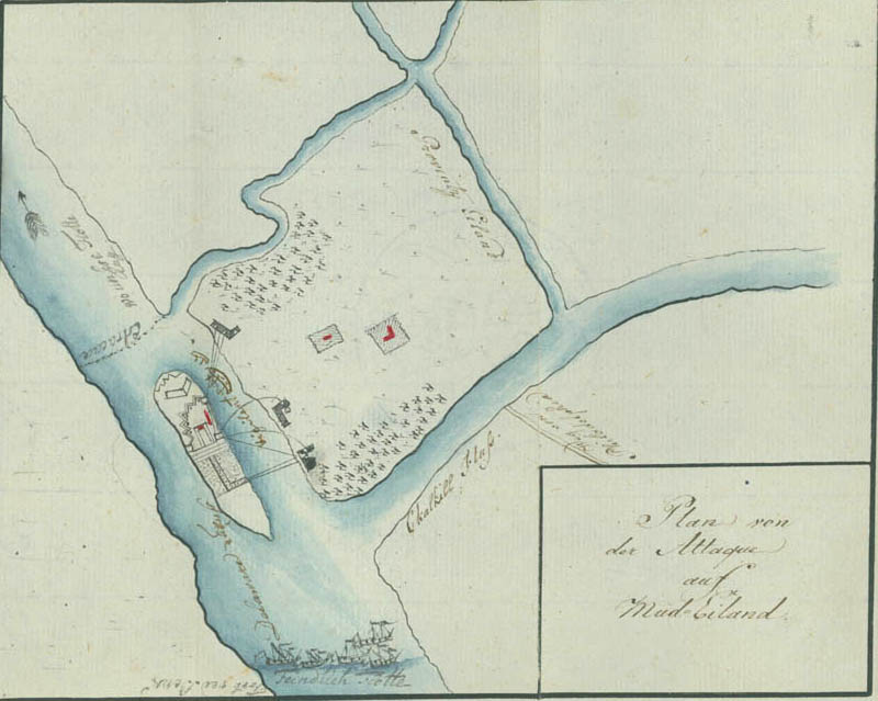
Plan of the Attack on Mud Island
Ewald's two plans actually show Fort Island. Mud Island, situated several hundred yards upstream was often confused with Fort Island, on which Fort Mifflin was located. Here three British batteries are shown firing on Fort Mifflin from Province Island (which includes Carpenters Island in this plan), aided by H.M.S. Vigilant and a sloop. To the left of the plan, above the estacade or chevaux-de-frise in the river, the inscription reads "Where our feet lay." At the bottom, in the river, is the "Enemy Fleet" opposite "Fort Red Bank." The L-shaped mark on Province Island probably represents the Bleakley or Blakely house, which was struck three times by cannonballs during the siege and was afterward known as "Cannonball House." A British redoubt was located near this house.