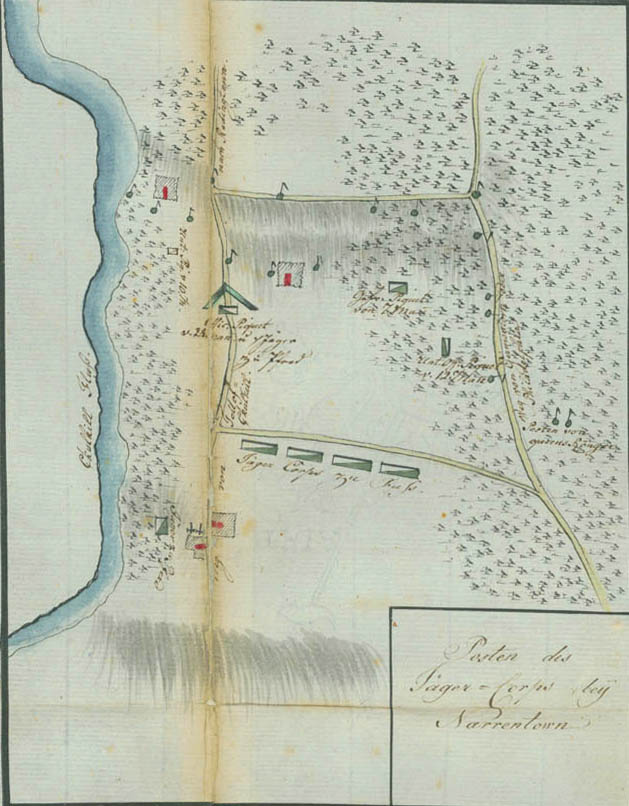
Post of the Jäger Corps Near Norriton
This plan shows Ewald's position on the eve of the Battle of Germantown. The "Road from Falls of Schuylkill" at the left is Ridge Road (now Ridge Avenue), then known also as the Manatawny Road or Wissahickon Road, which led to Norriton Township. Washington's right wing under Major General John Armstrong advanced down this road toward daybreak on October 4, 1777. The house to the left of the road, where the two guns are shown, probably represents Dr. William Smith's country seat, sometimes called "Smith's Octagon" (from its semioctagonal bay) or "Smith's Folly," which overlooked the Schuylkill River. The position of the mounted jägers is shown by the box between the river and the house with the guns; the line of the foot jägers extends across the lower center. Several pickets are indicated by smaller blocks, and the round markers with pennants represent individual outlying sentries. To the right, across the "Road from Germantown or Philadelphia," is the post of Simcoe's Queen's Rangers.