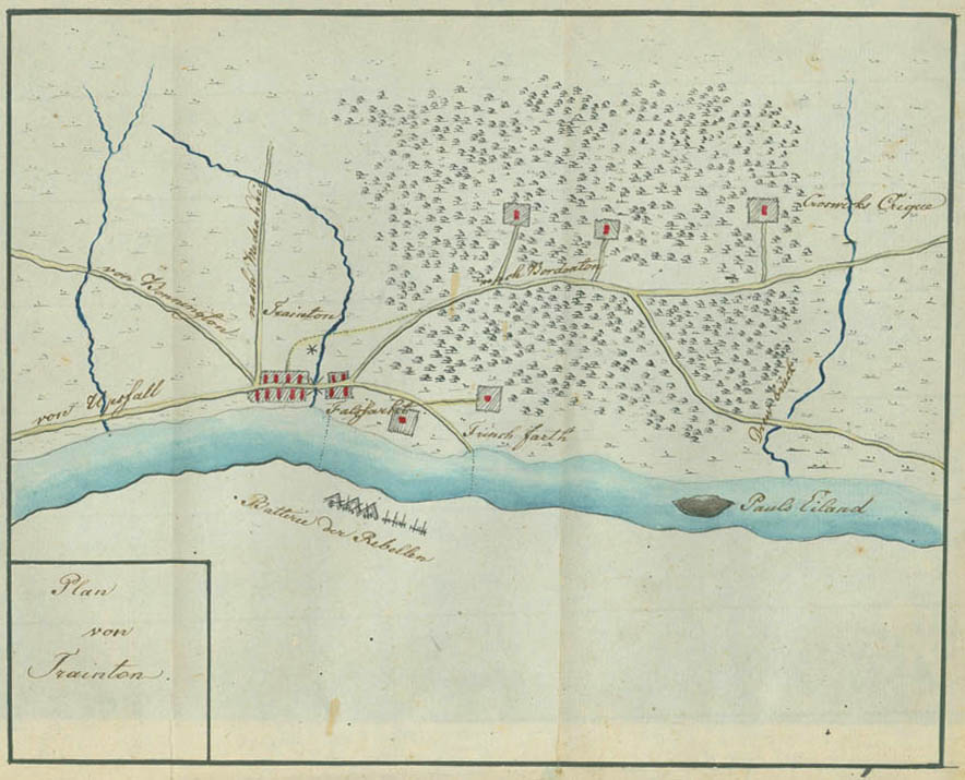
Plan of Trenton

This plan shows the village of Trenton before the battle. Like the plans of the Bordentown, Burlington, and Mount Holly areas that follow, it may have been drawn during the period between the occupation of Trenton and the abandonment of Mount Holly, December 8 through 26, 1776. Assunpink Creek, crossed by a bridge, runs through the village. The roads to Upper Falls, Pennington, Maidenhead, and Bordentown branch out in various directions. The asterisk may represent the wheel of a mill. Below on the left bank of the Delaware River is Falls Ferry, and to the right Trent Ferry, the dotted lines indicating their crossings. The small dark squares in larger shaded squares represent houses surrounded by gardens or fields. Between the two ferry landings on the left bank is Trent House, with the Eagle Tavern across the road to its right. Still further to the right the drawbridge over the Crosswicks Creek is indicated. The batteries of American guns are shown drawn up on the opposite bank of the Delaware.