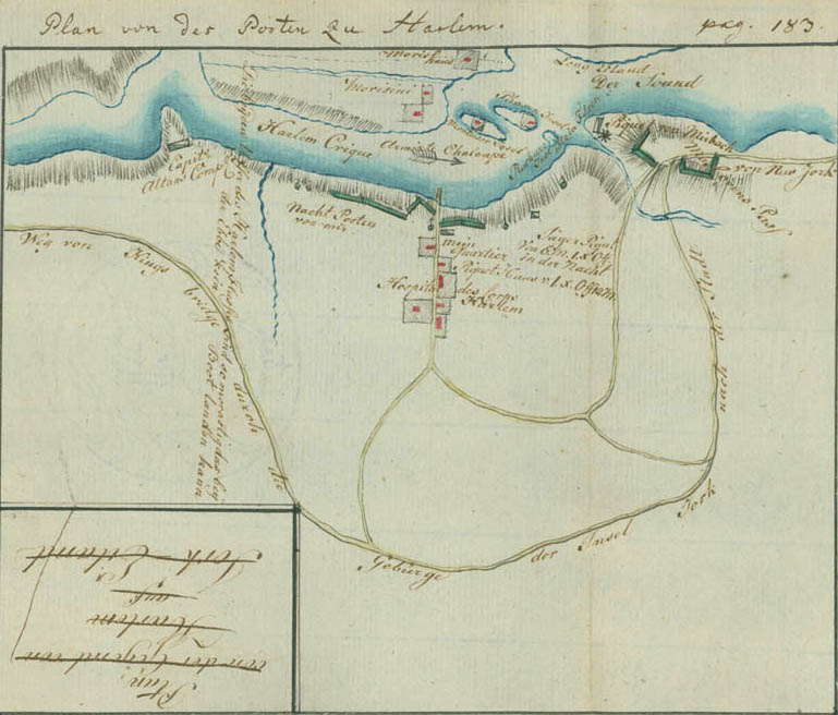
Plan of the Post at Harlem
This plan shows the Hessian Field-Jäger Corps stationed in and around Harlem and along the right bank of the Harlem River. Morrisania lies across the river, with the Morris House, now in the lower Bronx of New York City, shown above. An armed sloop is noted in the river. The islands shown are not in their correct geographical locations. Montresor's Island is now Randalls Island; "Phasen Island" was Barren Island, now Ward's Island; and "Ruckurs Island is a rock" is Rikers Island. At the left of the plan is the post of Captain John Althouse, New York Volunteers. The vertical writing states, "The two banks of the Harlem River are so marshy that no boat can land at low tide." The round markers with pennants along the river bank are sentries. Ewald has labeled the defense barrier at the river "My night post."