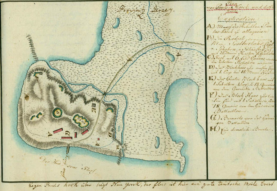
Plan of Paulus Hook and its Works
Paulus, or Powles, Hook is the modern Jersey City. The fort is said to have been located near the present Washington and Grand streets. This plan may have been made around the time of Lee's exploit, for it shows his route of attack and withdrawal. Ewald's inscription reads as follows: "Explanation. A. March of the rebels to attack Paulus Hook. B. The redoubt which Major Sutherland, Captain von Schaller, and Ensign [Georg] Cress defended with twenty-five Hessians. C. Fort with six fieldpieces, of which the rebels took possession. D. The blockhouse on the right side with one corporal and fifteen Hessians. E. The center blockhouse with one subaltern, one sergeant, and eighteen privates of the garrison battalion. F. The blockhouse on the left side with one subaltern and eighteen privates of the garrison battalion. G. Barracks of the garrison battalion. H. A demolished bridge." The remark at the bottom of the plan in Ewald's handwriting reads: "Paulus Hook lies opposite New York, the river here is a good German mile wide."