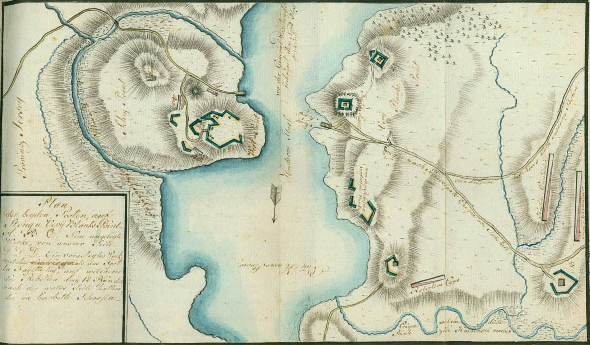
Plan of the Two Posts on Stony and Verplanck's Points
This plan may have been made about the time Clinton took Stony and Verplanck's Points on May 31 and June 1, 1779, since it shows Stony Point occupied by the 17th, 40th, and 45th British regiments, with jägers on an outlying hill. When Wayne took the fort on the night of July 15 the garrison consisted of the 17th Regiment, the grenadier company of the 71st Regiment, a body of Loyal Americans, and an artillery detachment. Stony Point was open on the side toward the river, which is here marked "WestPoint," perhaps because of its position on the west side of the river. The road above the fort leads to King's Ferry, which crossed to Verplanck's Point. The inscription in the river between the ferry landings reads, "Where General Washington always crossed the North River." Fort Lafayette lies just above the ferry landing on Verplanck's Point. The inscription along the lower road reads, "Road to Hereckland's Creek or Peekskill," and along the upper road, "The very same, particularly to our posts." Below the road on the left bank of the river are the "Works completed by the rebels." At the bottom of the plan is the "Creek which makes this Point a peninsula." The troop dispositions show Robertson's (Robinson's) Corps below, and the Hessian and English grenadiers at the extreme right. The legend in the box reads as follows: "Plan of the two posts on Stony and Verplanck's Point. A.B.C. Newly constructed works on our side. D.D.D. An outlying work which lay lower than Fort Lafayette, in which the rebels had three 18-pounders on the rampart side which fired en barbette." The letters given in this description are missing from the plan, except for the letter B, which is found at the extreme lower right.