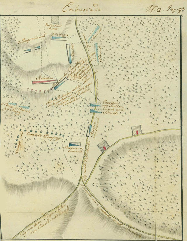
Ambuscade [August 31, 1778]
This skirmish was later known as the action at Indian Field or Indian Bridge. At the upper left of the plan, below Valentine's house, the Americans and Indians are shown surrounded by the companies of Simcoe, Emmerich, and Ewald. To the left of the vertical road the legend reads, "Place where the cavalry fell upon the rebel infantry after its retreat was cut off," and below this, "Small parties which advanced quickly as soon as the rebels retreated." The cavalry of Tarleton, Emmerich, and Simcoe are shown on the "Road to East Chester and Mile Square" before the attack, with reserves of Emmerich and Lorey's and Ewald's company to the left. The road forks below, with legends indicating the "Road from the Jäger post by Cortlandt's house" to the left and the "March of Simcoe and Emmerich" before the attack to the right.