|
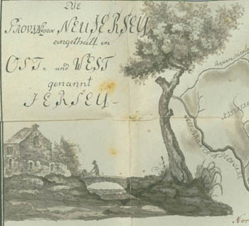
The Province of New Jersey Divided into East and West called Jersey |
|
|
Detail of artwork from the map. |
|
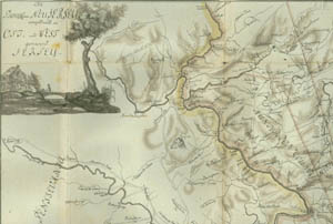
The Province of New Jersey Divided into East and West called Jersey |
|
|
Detail of artwork from the map. |
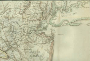
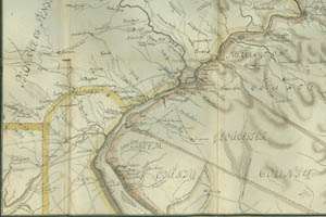
Click on a quadrant of the map for a larger view.
|
|
|
|
|
|
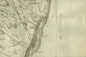
Ewald's map, folded in the back of Volume I, appears to be a partial copy of a map entitled The Province of New Jersey, Divided into East and West, commonly called The Jerseys, engraved and published by William Faden of Charing Cross and bearing the date of December 1, 1777. Keith's Line refers to a boundary line intended to mark the border between East New Jersey and West New Jersey, the two provinces into which New Jersey was divided before it became a united Royal Colony in 1702. Since the boundary had been disputed for some time, George Keith (c. 1638-1716), surveyor-general of the province, began the survey of a line in 1687 (not 1787 as stated on the map) to settle the issue; but the line was never completed, because protests by West Jersey over favoritism to East Jersey forced a halt.