|
|
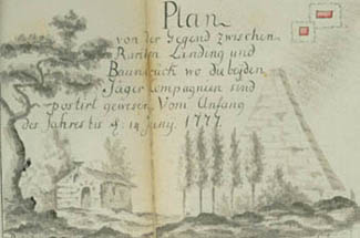
Plan of the Area Between Raritan Landing and Bound Brook
Where the Two Jäger Companies Have Been Posted. |
|
|
Plan of the Area Between Raritan Landing and Bound Brook
Where the Two Jäger Companies Have Been Posted. |
Click on a section of the map for a larger view.
|
|
|
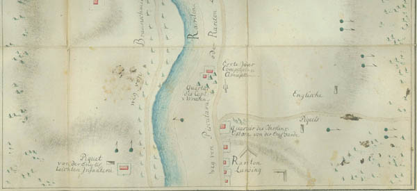
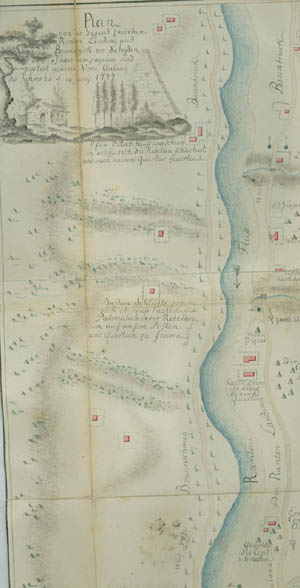
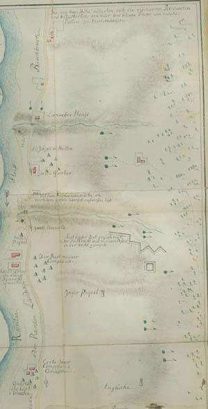
This plan shows the jäger pickets on the left bank of the Raritan River below Bound Brook. The round markers with pennants indicate jäger sentries. A picket of the English light infantry is located on the right bank in the lower left-hand corner of the plan. The small sketch in the upper left-hand corner represents Reverend Abraham Beach's house and barn or granary. The inscription under the house and barn reads: "Pastor Beach's house and barn, into which the rebels sneaked and fired at my quarters." Ewald drove the Americans out of the barn with an amusette. This plan was probably drawn by Lieutenant Carl Moritz von Donop, 1st Jäger Company; the signature under the sketch reads "v. D. fecit."