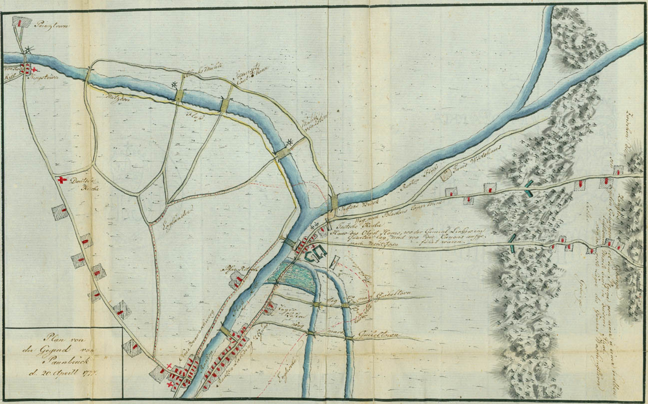
Plan of the Area of Bound Brook, 20 April 1777
This plan shows the four routes of the attack on Bound Brook on April 13, 1777. New Brunswick is located in the lower left of the plan, across from Raritan Landing. Ewald's advanced guard of General Grant's column attacked on the road over the causeway near the morass or open shaded section above Raritan Landing. Across the river from the morass is the house of the Reverend Abraham Beach ("Pfar Ritsche"), pastor of Christ Church in New Brunswick. Bound Brook and its works are shown between the morass and the Van Veghten Bridge, also called long Bridge, in the center of the plan. The inscriptions read: "German Church" and "House of Colonel Horne, where the quarters of General Lincoln were situated, and where the cannon were mounted." Judge Phillip Van Horne's house was known as Phil's Hill or Convival Hill. The three wheels at the bridges in the upper left of the plan represent mills on the Millstone River. The approaches to Washington's first winter encampment at Morristown, with the barriers in the First Watchung Mountains, are shown at the extreme right of the plan. The inscription reads: "Between these two mountains in this valley is a plain one and a half English miles in the breadth, in front of the rest camp of General Washington." To the right a part of the Second Watchung Mountains is shown.