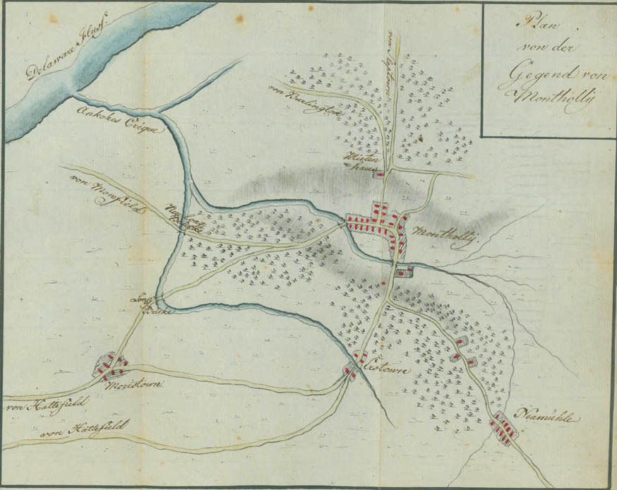
Plan of the Area of Mount Holly
Just north of Mount Holly at the junction of the Slabtown (Jacksonville) road, the road to Burlington, and Woodpecker Lane, is the old Friends Meeting House, which was situated at the base of the mount where the so-called Battle of Mount Holly occurred on December 23, 1776. Ewald reconnoitered the area across the North Branch of Ankokes (Rancocas) Creek to the Long Bridge (now Hainesport), which is on the South West Branch of the same creek. In the lower right of the plan is New Mills (now Pemberton), where Ewald captured Lieutenant Colonel Thomas Reynolds and two captains early on Christmas morning.